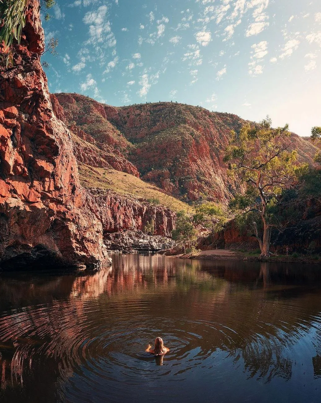
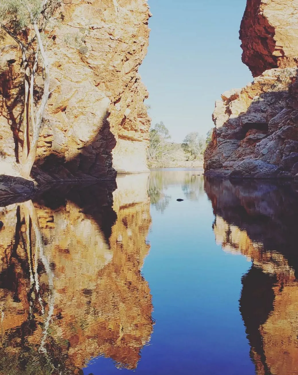
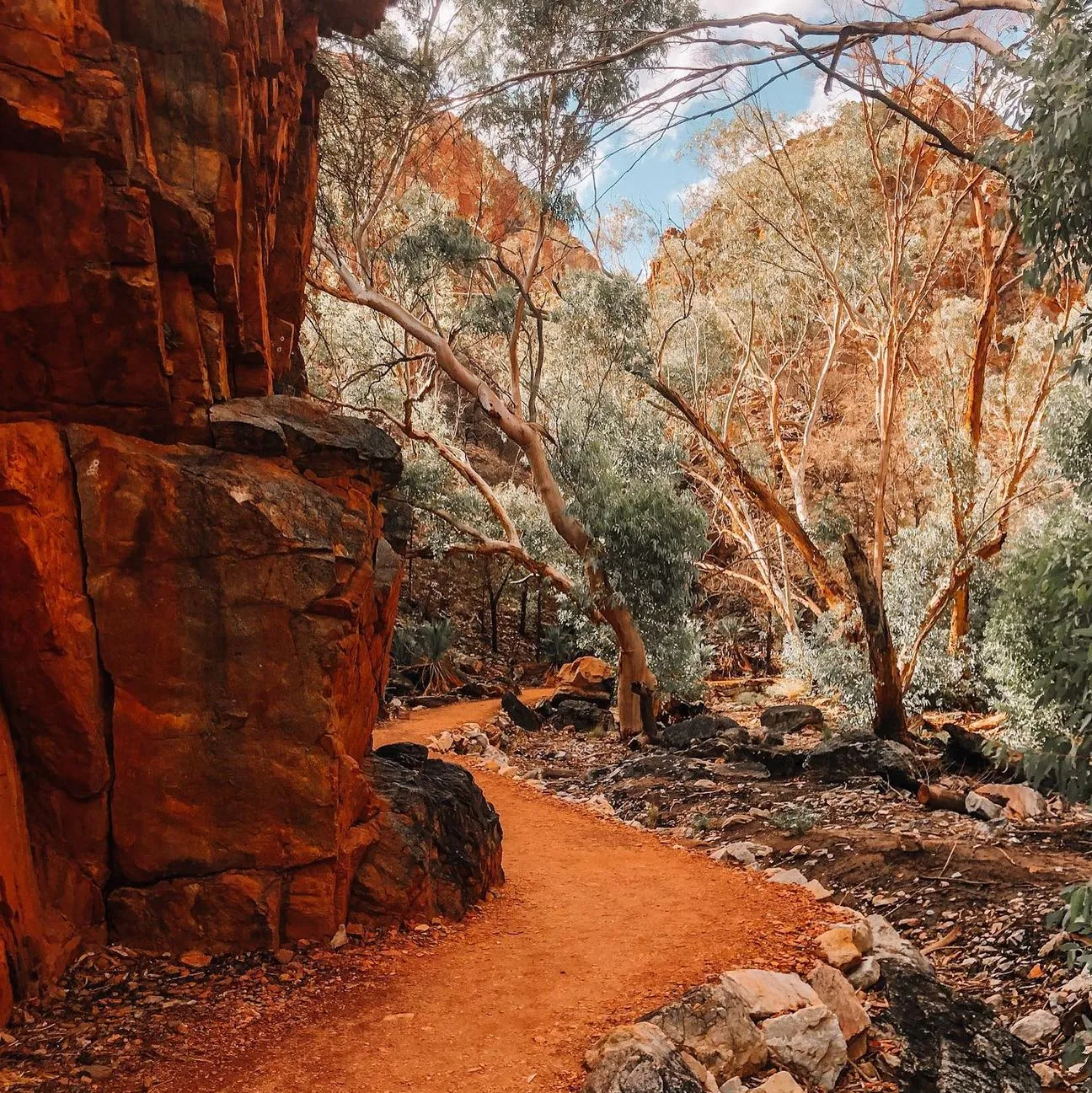
The Larapinta Trail, one of Australia’s biggest desert treks, has stunning views, amazing geology and an unforgettable adventure through the Outback. Winding through Alice Springs, the trail takes walkers through Redbank Gorge, Ormiston Gorge, and Ellery Creek South. Whether you’re an independent walker, a fit hiker or part of a guided group, knowing the best time to walk the Larapinta Trail will mean a safe, enjoyable trip with access to water, accommodation and comfortable hiking conditions.
Best Time to Hike the Trail
The Larapinta Trail is open all year round but the cooler months (April to October) are best for walking conditions. Daytime temperatures range from 20°C to 30°C and nights drop below freezing, especially in winter. Let’s look at what each season has to offer for this epic trail.
Autumn (April to May)
Autumn is one of the best times to walk the Larapinta Trail with mild temperatures. Daytime temperatures are 20°C to 30°C and night temperatures are 10°C to 15°C. The cool breeze during the day and crisp air at night makes for comfortable walking. Autumn also means you can enjoy the pristine desert scenery and see wildflowers along the trail, especially around Ellery Creek North and Fringe Lily Creek.
As you walk through Simpsons Gap and Ormiston Gorge you’ll have stunning views with minimal other walkers as autumn sees fewer visitors. Autumn is great for those who want solitude between walks and an epic adventure.
Pros:
- Pleasant daytime temperatures (15°C – 28°C).
- Cool mornings and evenings.
- Post summer landscapes with greenery.
- Less chance of rain.
Cons:
- Nights can be very cold so bring warm gear.
- Some water sources may still be drying out from summer.
Best For: Walkers who like mild weather and fewer people.
Winter (June to August)
Winter offers perfect trekking conditions with daytime temperatures of 15°C to 25°C (59°F to 77°F) and cold nights that can drop below zero. While winter months are the coolest months to trek, the night temperatures require proper preparation, including the right camping gear for warmth. Serpentine Chalet Dam and Razorback Ridge are popular spots for winter hikers to enjoy the peace and quiet and dramatic scenery. But remember these cold nights will require extra gear like insulated sleeping bags and layers of clothing.
Winter is also good for those who don’t like crowds on the trail and want an immersive solo experience. You can camp at Mulga Camp, enjoy the views at Ghost Gum Flat, or relax after a day’s walk at Glen Helen Gorge. This time of year is also perfect for tackling the steep climbs of Inarlanga Pass and Euro Ridge, so it’s a favourite for more experienced hikers.
Pros:
- Coldest temperatures, 5°C – 22°C.
- Clear skies and starry nights.
- Perfect for multi-day hikes.
- Minimal risk of dehydration compared to hotter months.
Cons:
- Very cold nights (-2°C).
- High demand for guided tours and campsites, book early.
Best For: Serious hikers looking for perfect trekking conditions.
Spring (September to October)
As the temperature rises in spring, daytime temperatures are 25°C to 35°C (77°F to 95°F) so it’s warm but not too hot. Spring is also the time of year the wildflowers bloom, especially around Waterfall Gorge, Lily Creek and Ellery Creek Big Hole so it’s one of the best times to walk the Larapinta Trail. Hiking in spring is good for those who like a moderate climate and amazing views and Australian geology. As spring gets underway, temperatures will start to rise so stay hydrated, especially in areas like Jay Creek and Rocky Gully. Water drops are scheduled during this time to ensure water at key points along the trail, including food caches at Serpentine Chalet and Glen Helen Gorge.
Pros:
- Comfortable daytime walking in early September.
- Wildflowers and beautiful scenery.
- Fewer walkers than in winter.
Cons:
- Temperatures rise quickly (can be over 30°C by late October).
- Water sources dry up.
Best For: Those who want a quiet trail and can handle warm conditions.
Summer (November to March)
Summer brings hot weather, with temperatures often over 40°C (104°F). This is the worst time to hike the Larapinta Trail, as heat stroke risk is high. Hiking in warm months without proper preparation (satellite phone, extra water, spare batteries and food) is dangerous. The trail heads like Ellery Creek and Telegraph Station may be closed or inaccessible due to heat and lack of water sources.
If you do choose to hike in summer, planning and preparation is critical and food drops should be arranged well in advance.
Why Avoid Summer?
- Daytime temperatures are often over 40°C.
- High risk of dehydration and heatstroke.
- Limited water availability.
- National parks advise against hiking in extreme heat.
Best Alternative: If you must hike in the summer, do shorter hikes in the morning or evening instead of the full trail.
Key Factors to Consider
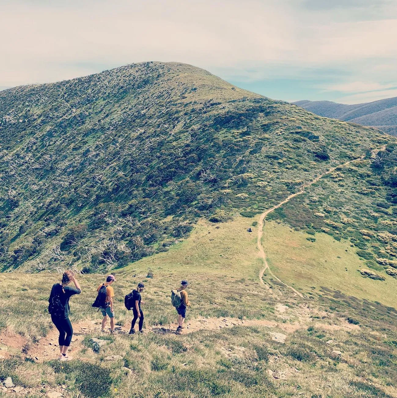
- Fitness Level: The Larapinta Trail is tough, with steep climbs like Razorback Ridge and Euro Ridge, make sure you are in good shape.
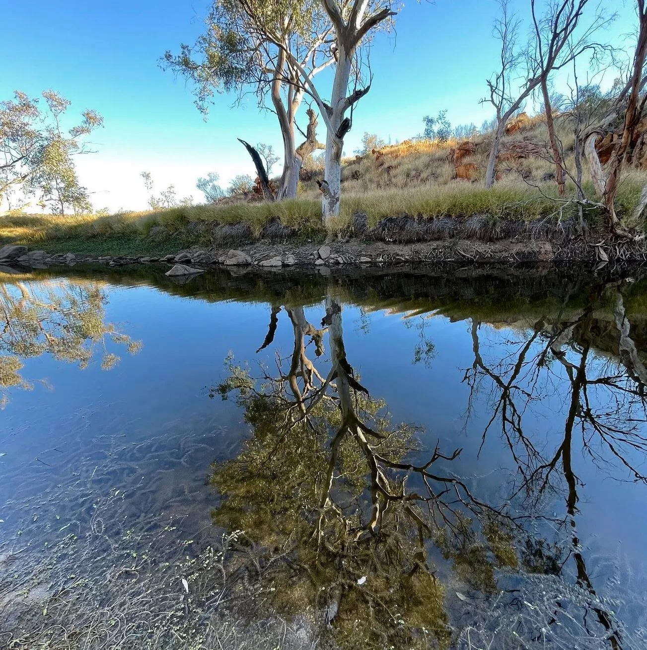
- Water: There are water tanks and creek beds like Fringe Lily Creek and Glen Helen Gorge to refill water. But still carry your own water bottle and extra water, especially on longer sections between food drops.
- Camping: Depending on your budget and comfort, you can choose from Eco-Comfort camps, camping spots or more rough options. Check camping fees at sites like Rocky Bar Gap and Ghost Gum Flat.
- Solo or Supported: For independent hikers, plan ahead for access to showers, food drops and trail transport. For Larapinta Trail Trek Support opt for an organised tour with an expert guide for a safer and more enjoyable hike.
By hiking during peak season (autumn, winter, spring) you’ll have a great time in one of Australia’s most beautiful landscapes.
FAQ
How long does it take to walk the Larapinta Trail?
The full Larapinta Trail is 223 km and takes 12-16 days to complete depending on fitness level and pace. Many hikers do sections over a couple of days.
Do I need a permit to walk the Larapinta Trail?
No permits are required for independent walkers but camping fees apply at some campsites. Register your walk for safety reasons.
What’s the toughest section of the trail?
The most challenging bits are Euro Ridge, Inarlanga Pass, and Razorback Ridge due to steep climbs, rocky ground and limited water access.
Is there mobile phone reception on the trail?
Phone reception is limited along the trail with some coverage near Alice Springs, Ormiston Gorge, and Simpsons Gap. A sat phone is recommended for emergencies.
How do I manage food and water on the walk?
Walkers should plan for food drops, use Larapinta Food Drops or food caches and carry at least 3-5 litres of water per day. Some water sources are available at designated water tanks.