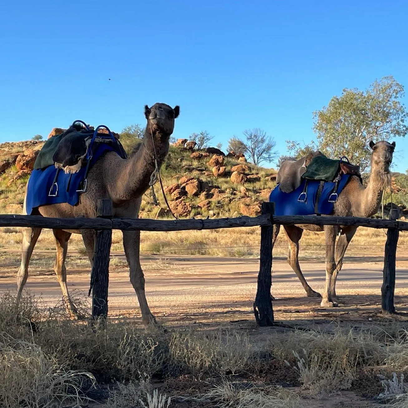
The Larapinta Trail is one of Australia’s most famous long-distance hikes, 223km through the rugged and stunning West MacDonnell Ranges in the Northern Territory. This tough but rewarding trek attracts adventurers from around the world, with breathtaking views, rich Indigenous history and a real test of endurance. If you’re planning to do this epic journey, knowing where the Larapinta Trail starts and how to prepare is key. This guide will give you all you need to know to start your Larapinta adventure.
Historic Start
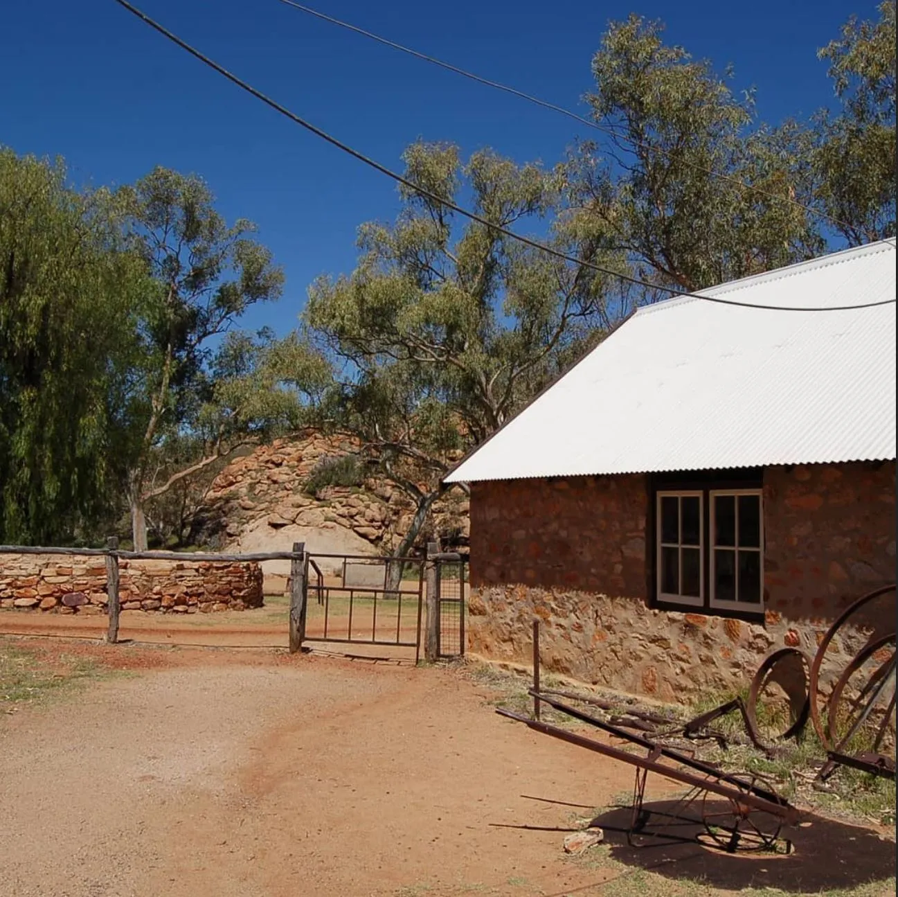
The official start of the Larapinta Trail is at the Alice Springs Telegraph Station, a historic site that dates back to 1872. This historic site was the key to establishing communication between Australia and the rest of the world. Just a few km from the Alice Springs CBD, the Telegraph Station is a great introduction to the area’s cultural and historical significance and the perfect gateway to the stunning landscapes on the trail, including Euro Ridge, Wallaby Gap and Simpsons Gap.
How to Get to the Trailhead
Getting to the Larapinta Trailhead at the Alice Springs Telegraph Station is easy. The station is about 4km from the Alice Springs CBD, so:
- By Car: 10-minute drive from the town centre via the Stuart Highway and Herbert Heritage Drive.
- By Bike or Walking: Well-maintained paths from the CBD to the station, perfect for those who want to get active.
- By Taxi or Shuttle: Several local transport services will take you to the trailhead if you don’t want to drive.
- By Tour Operator: If you’re doing a guided hike, your tour provider may include transportation to the start.
Preparing for Your Adventure
To have a good time and a successful trek, preparation is key. Here’s what you need to know:
1. Best Time to Trek
The best time to trek the Larapinta Trail is during the cooler months, April to September. Daytime temps are between 15°C and 25°C. Summer months (October to March) are to be avoided due to extreme weather conditions and temps that can be deadly.
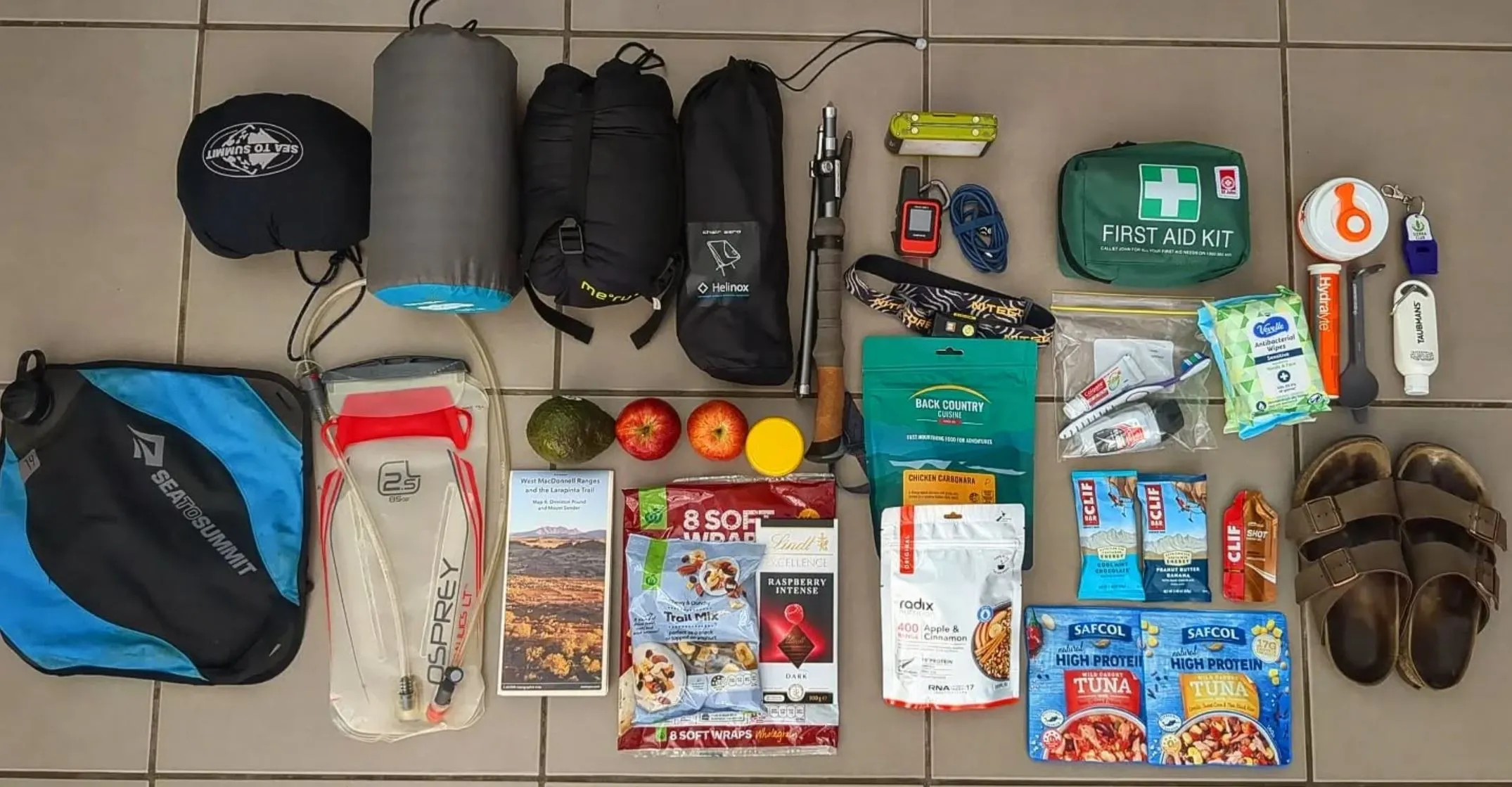
2. Essential Gear
Packing the right gear is critical for a safe and enjoyable experience. Don’t forget:
- A good backpack or day pack
- A lightweight and durable tent or swag
- A warm sleeping bag (it can get cold at night)
- Water-carrying capacity (at least 3-5 litres per day) and a refillable water bottle
- Sturdy hiking boots for rocky terrain
- Maps and a GPS
- First aid kit
- Sun protection: hat, sunscreen and sunglasses
- Lightweight, moisture-wicking clothes for temperature changes
- Muesli bars and food drops
- Camp setup and pop-up shower for comfort
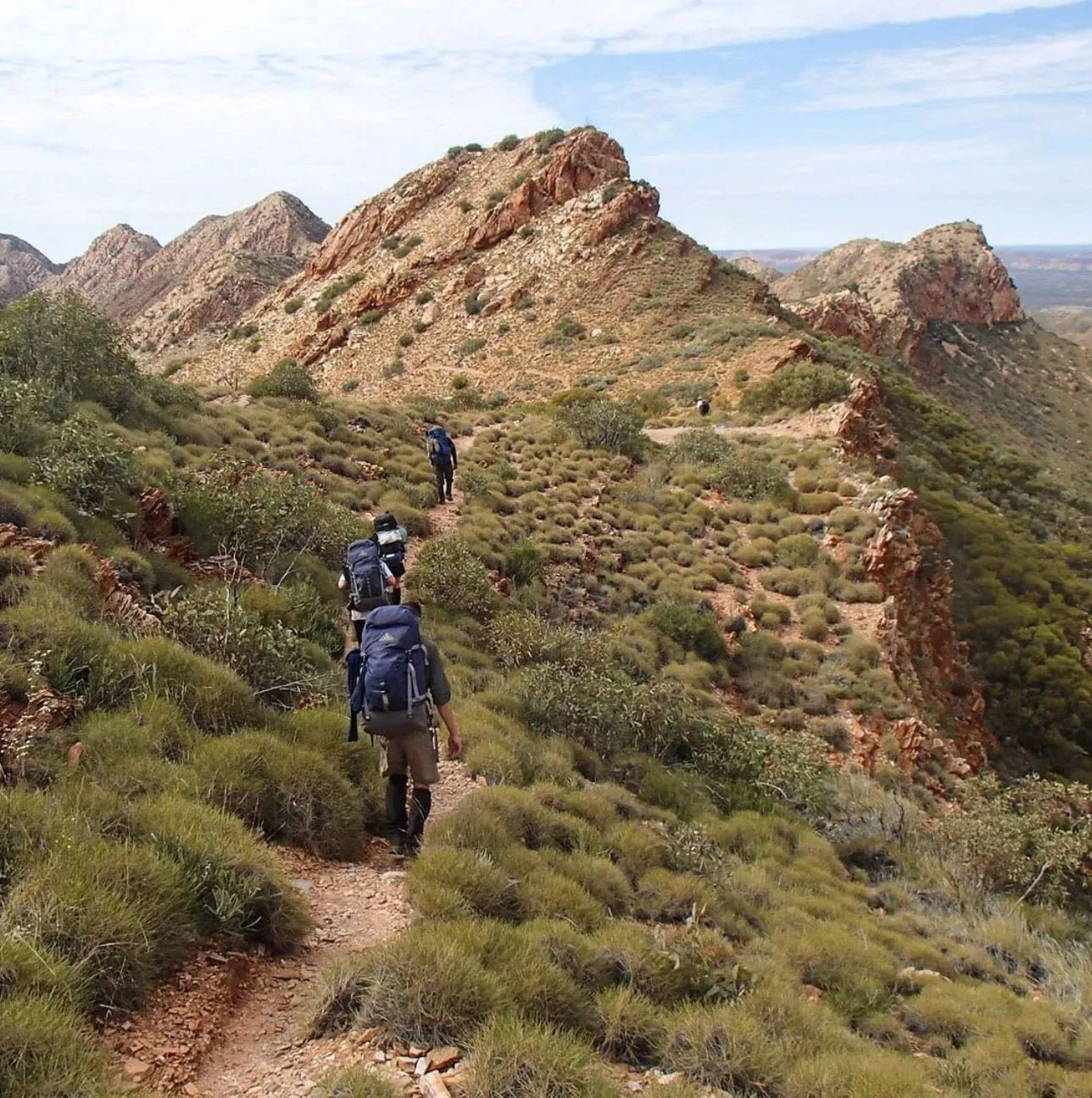
3. Fitness Level & Trail Difficulty
The Larapinta Trail is tough, steep and rocky with long stretches between campsites. Some sections, Brinkley Bluff, Razorback Ridge and Rocky Gully require advanced fitness. While some sections are moderate, the whole trail requires high fitness and endurance. Train in advance with long-distance hikes and a weighted pack.
4. Permits & Safety Considerations
No permit is required to trek the Larapinta Trail but it’s highly recommended to register with NT Parks and Wildlife. Safety considerations:
- Check the weather before you go
- Carry emergency communication devices, PLB (Personal Locator Beacon)
- Know water points along the trail, water refill stations
- Be aware of local wildlife, snakes and insects
- Have personal travel insurance, cancellation policies and emergency contact support.
Looking to explore more of the Land Down Under?
If you’re planning to trade the red dust for some salt spray after your trek, hitting the coast is a top notch idea. For a total change of scenery, check out Great Ocean Road Tours Australia to see some of the country’s most iconic coastal landmarks.
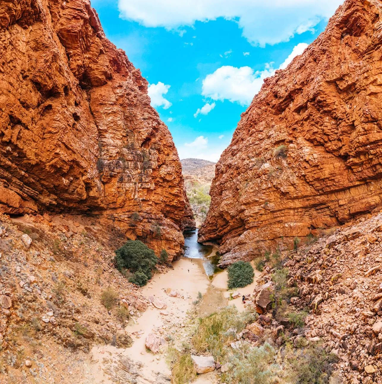
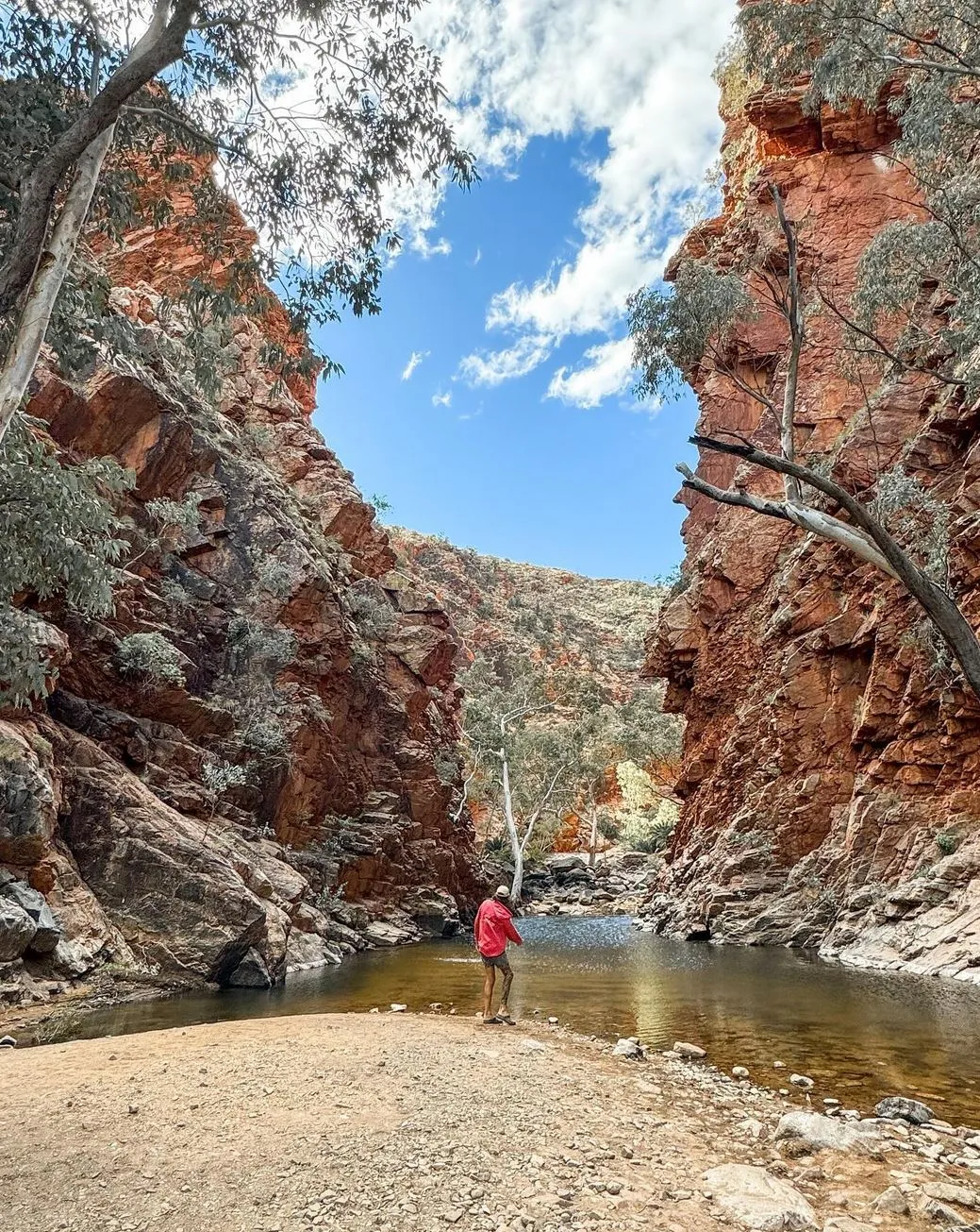
What to Expect in the First Section
The first section of the Larapinta Trail, from Alice Springs Telegraph Station to Simpsons Gap (approximately 24 km) has a mix of rough terrain, creek beds and mountain views. This section gives hikers a taste of what’s to come and has:
- Historical insights at the Telegraph Station
- Panoramic views from Euro Ridge
- Varied terrain, including Spencer Gorge and Millers Flat
- Native birds and rock wallabies
- Water refill stations at designated points
This section is a great introduction to the trail and sets the scene for an amazing adventure ahead.
Plan Your Adventure
Hiking the Larapinta Trail is a big adventure and requires planning and preparation. Whether you’re tackling the whole 223 km or just certain sections such as Serpentine Gorge, Hugh Gorge, Ormiston Gorge, Redbank Gorge or Glen Helen, knowing where to start and how to prepare will ensure a safe and enjoyable journey. Many hikers opt for comfortable Eco-Comfort camps where hot showers and night accommodations are available, making for a more enjoyable trek. Take the first step today and start your outback adventure!
FAQ
Do I need a permit to hike the Larapinta Trail?
No permit is required but hikers should register with NT Parks and Wildlife for safety reasons.
How long does it take to hike the Larapinta Trail?
The whole trail takes 12 to 16 days to complete depending on fitness level and daily distance.
Are there water sources along the trail?
Yes, water tanks are at designated points but availability may vary. Hikers should carry sufficient water and check water supply updates.
Can I hike the trail solo?
Yes, solo hiking is possible but requires thorough preparation including a PLB for emergency communication and food cache drops.
What are the booking conditions for guided tours?
Guided tours require booking confirmation and insurance policy covering cancellation conditions, cancellation fees and unrecoverable costs due to extreme weather events. Check the booking conditions with your tour provider before confirming your travel arrangements.