The Larapinta Trail, in the Northern Territory of Australia, is famous for its spectacular landscapes, tough terrain and views. Stretching 223km, this desert trek has something for every hiker, from rough tracks to smooth walking paths. Whether you are an experienced hiker or a beginner, there are numerous short sections to allow you to experience the Larapinta Trail in a more manageable way. These hikes are perfect for independent hikers or those who want to experience central Australia without committing to the whole trail. Let’s explore the best sections for a short hike.
1. Simpsons Gap to Bond Gap
Distance: 7.2 km (return)
Time: 2-3 hours
Difficulty: Easy to moderate
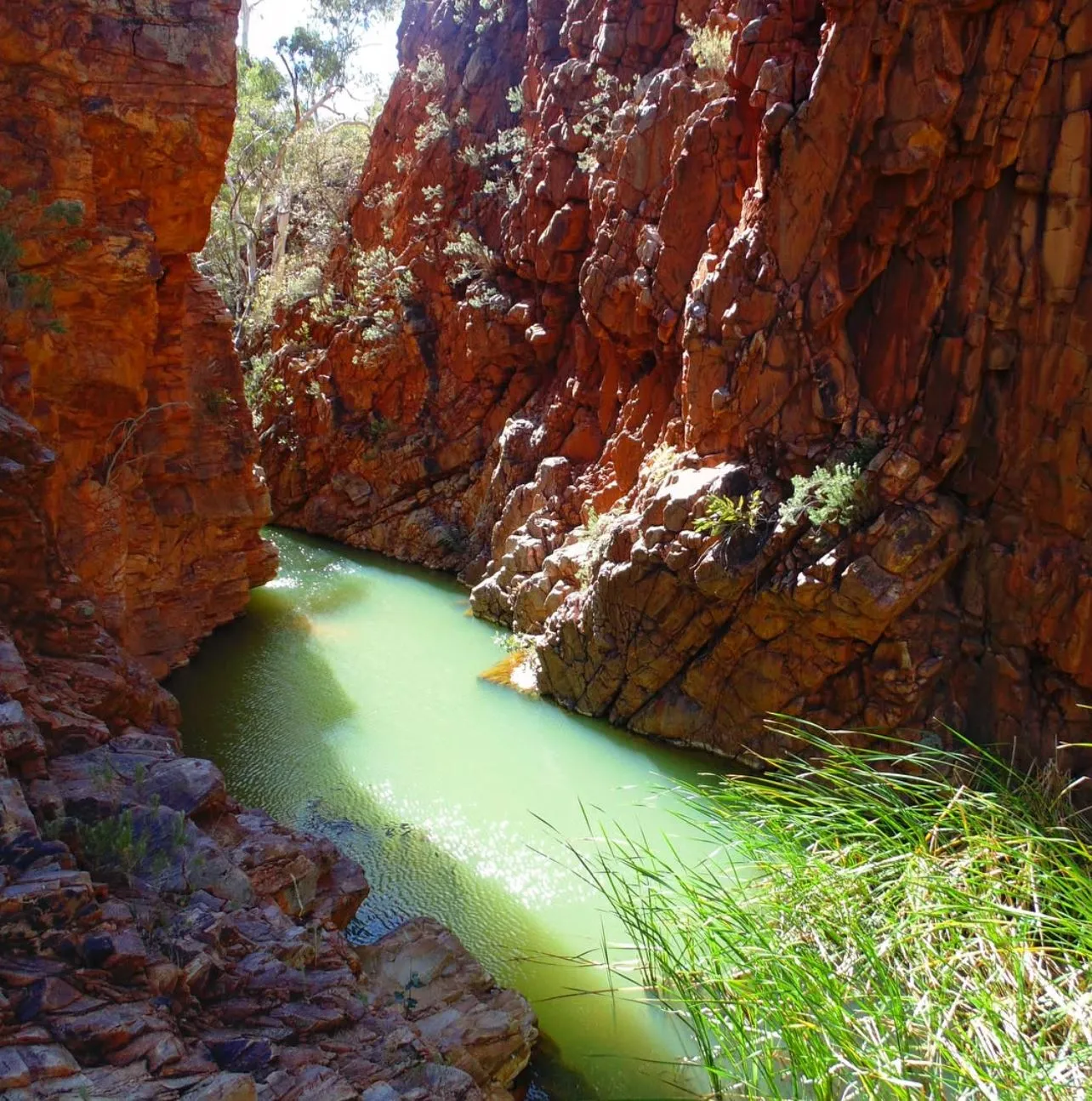
The hike from Simpsons Gap to Bond Gap is a great introduction to the Larapinta Trail. This section is easy to access and has a smooth track through rocky creek beds and views. The rugged terrain and rolling hills are moderate without being too hard. Black footed rock wallabies are a bonus on this trek. The trail goes through Millers Flat and has great views of the ranges. Make sure to carry extra water bottles or a water tank, as water is scarce. This is a great half-day hike, just the right amount of exercise and views without feeling rushed.
2. Standley Chasm Walk
Distance: 1.2 km (return)
Time: 30-45 minutes
Difficulty: Easy
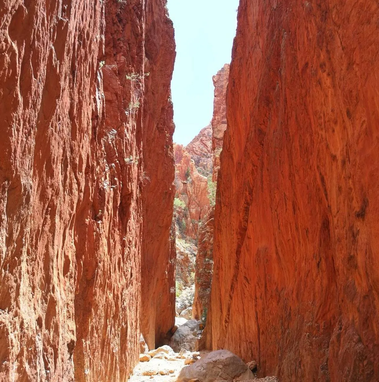
Standley Chasm is a short and easy walk to one of the most famous icons of the Larapinta Trail, the magnificent Standley Chasm. The rock walls glow red in the midday sun and are amazing to photograph. Suitable for families, beginners, or just to get out and about in the rugged country. With camp gear and campsites nearby, it’s an easy option to add on a night under the stars. Don’t forget your day pack and a food box or food bags for a picnic at the chasm. It can be done in a couple of hours, and the views are a must-see on the trail.
3. Ormiston Pound Walk
Distance: 3-4 km (depending on route)
Time: 2-3 hours
Difficulty: Moderate
The Ormiston Pound Walk is a moderate walk with great views over Ormiston Gorge, a natural amphitheater in the West MacDonnell Ranges. This section of the Larapinta Trail is known for its views and wildlife. Depending on the route you take, the walk can vary in difficulty but is doable for fit hikers and those with a good level of fitness. Be prepared for rocky terrain and steep sections, but the views from the top of the gorge are worth it. There are campsites and options to camp at Glen Helen Gorge and nearby. Bring a couple of litres of water, as water is
4. Serpentine Gorge to Counts Point
Distance: 6 km (return)
Time: 3-4 hours
Difficulty: Moderate to challenging
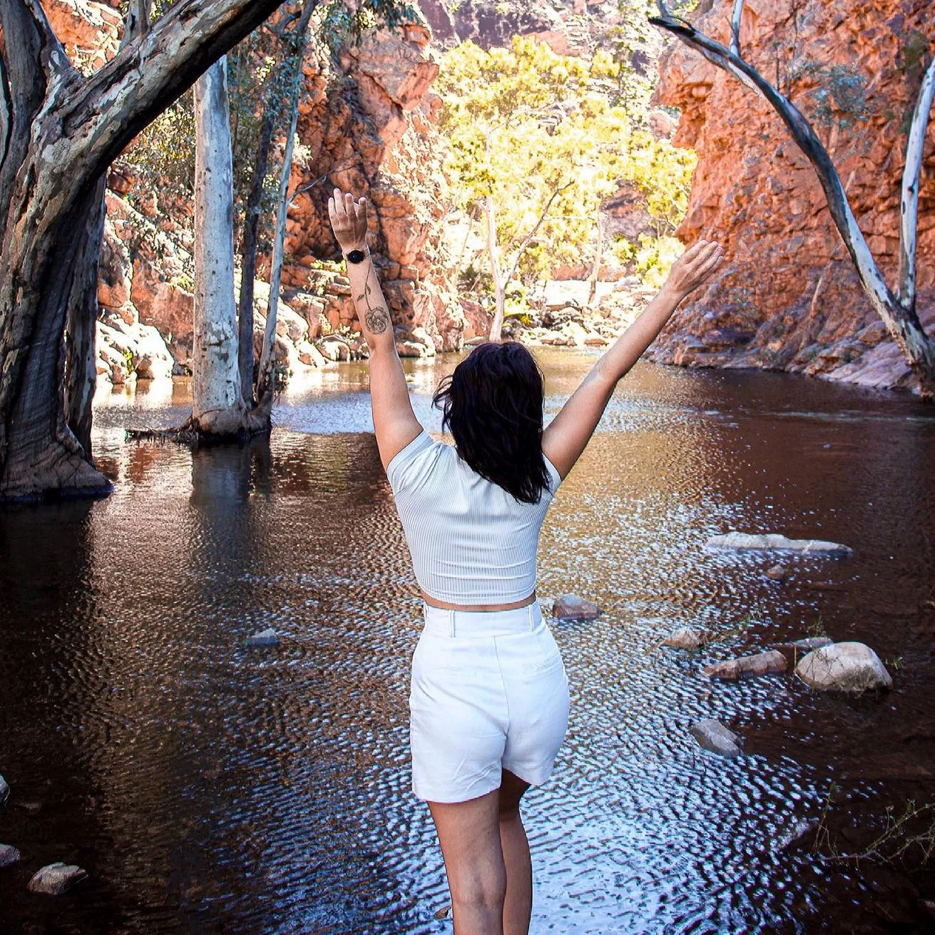
For a more challenging short walk, the trail from Serpentine Gorge to Counts Point has great views and tough terrain. This section of the trail has stunning views but is physically demanding due to the steep climbs. The walk starts at Serpentine Gorge, famous for its waterhole, and climbs up to Counts Point, where you will be rewarded with epic views over the surrounding ranges. This section is for experienced walkers or those with a higher level of fitness, as the climb can be tough. The views are worth it, and the rough terrain is fun. Bring extra water, food for energy (like muesli bars) and a heavy pack if you plan to camp overnight at one of the campsites in the area.
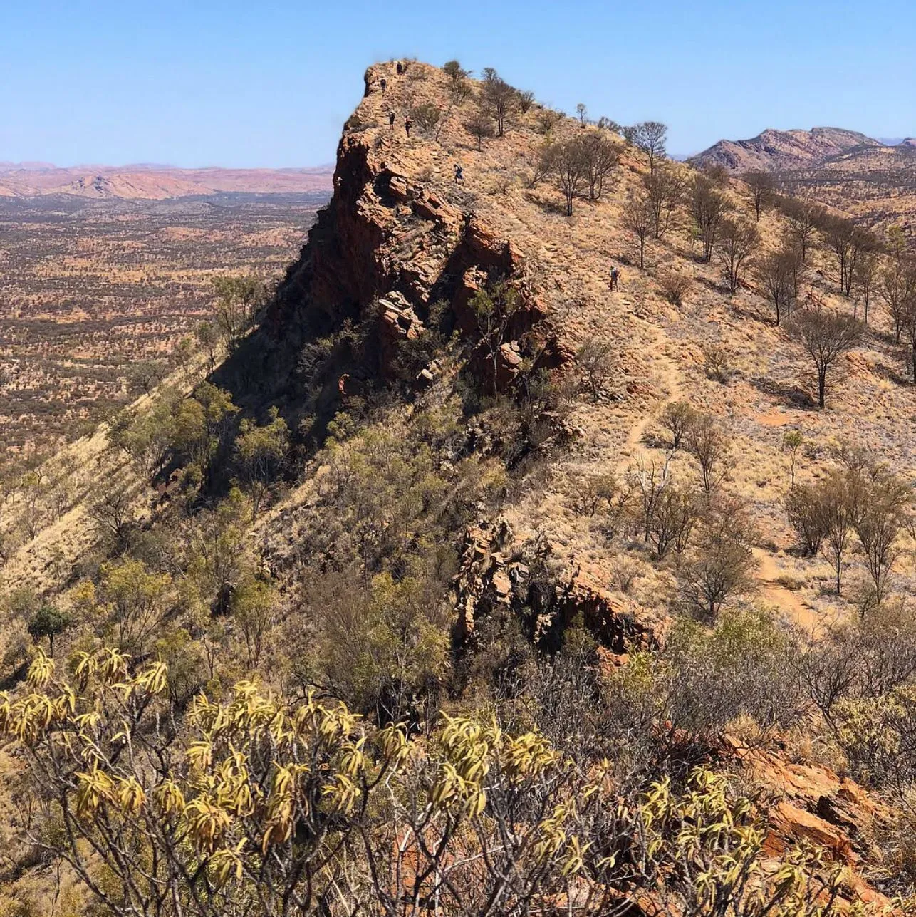
5. Euro Ridge Walk
Distance: 9 km (one way)
Time: 3-5 hours
Difficulty: Moderate
The Euro Ridge Walk is a longer but still doable walk that’s great for those looking for an adventure with big views. The 9-km trail takes you along the ridge with sweeping views of the surrounding ranges and gorges. You’ll see beautiful wildflowers and maybe even kangaroos or dingoes along the way. The challenging bits are rewarded with views at the top. The terrain is rough and rocky but perfect for walkers looking to test their fitness. This section is ideal for fit walkers who want an adventure and are close to eco-comfort camps and water sources like Glen Helen Gorge or Serpentine Chalet Dam. Make sure you have a water bottle or food dehydrator for extra water along the way.
Looking for a relaxing reward after your hike?
If you’ve enjoyed these bite-sized adventures on the Larapinta and are looking for your next iconic Australian experience, why not swap the rocky ridges for the rugged coastline? After a few days of trekking, there’s nothing better than a total change of scenery. If you find yourself heading south to Victoria, taking one of the Phillip Island Penguins Tours is a legendary way to see the famous Penguin Parade at sunset. It’s the perfect, low-effort reward after tackling the tough terrain of the Red Centre.
Conclusion
Whether you’re an experienced hiker or a beginner, the Larapinta Trail has short walks that offer stunning views, incredible landscapes and a challenging but rewarding experience. Just make sure to plan your walk according to your fitness level and bring enough supplies, water bottles, food caches and camping gear.
FAQ
How hard is the Larapinta Trail?
The Larapinta Trail is variable in difficulty. Some sections, like Standley Chasm and Simpsons Gap, are easier and suitable for beginners or families. Other sections, like Serpentine Gorge to Counts Point and Euro Ridge, are harder and require a good level of fitness and cardio fitness.
When is the best time to walk the Larapinta Trail?
The best time to walk the Larapinta Trail is during the cooler months, April to October. Summer temperatures can get over 40 degrees Celsius and is not suitable for walking, especially in the desert areas.
Can I walk the Larapinta Trail solo?
Yes, you can walk the Larapinta Trail solo, but be well prepared. Bring a map, plenty of water, a food box and a reliable head torch. It’s also important to let someone know your plans, especially if you’re planning to walk more remote sections like the Inarlanga Pass.
Where can I find water along the Larapinta Trail?
There are a few water sources along the Larapinta Trail: water tanks, creek beds and waterholes. But plan ahead, as access to water is limited in some sections. Always carry extra water bottles and consider using a food dehydrator to rehydrate during your walk.
Are there campsites along the trail?
Yes, there are several campsites along the Larapinta Trail: eco-comfort campsites, semi-permanent campsites and wild campsites. Some areas have access to drop toilets and other basic facilities, while others will require you to bring your own camping gear.